Idk… have you adjusted for map distortion?
What I would like to know is how big it is compared to Iberian Peninsula.
Huh, I wonder how it compares to that other country to the west there.
That’s Vermont. It’s not supposed to even be there.
Damn that’s a good shitpost.
So thats why the Portuguese description on products is always smaller than the Spanish one!
Jamón presunto
TIL: jamón en portugués es «presunto»
I would have read it as: jamón, presunto? supuesto? tal vez? quién sabe.
Presuntamente jamón, pero igual es papel reciclado.
Wow I never realized how small it was in comparison until I saw it here.
Spain is indeed small
Anyone who wants to play https://thetruesize.com/
This Azores erasure will not stand.
me lo voy a robar
do NOT steal Portugal!!
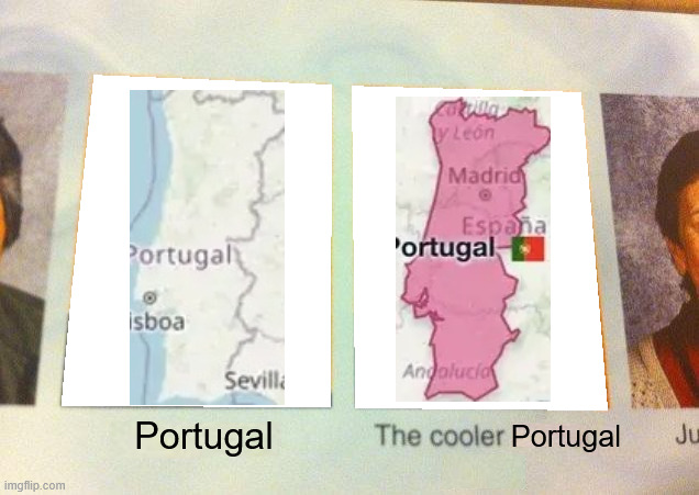
Can’t believe Portugal is nearly the same size as Portugal
Portugal 🇵🇹 does get the morning light tho
Umm doesn’t it get the beautiful sunsets?
A large Portugal the size of a small Portugal.
They are completely different colors, however. 🤔
Red Portugal is best Portugal
Oooh, I’m a rebel just for kicks, now
You’re the man
The Portugal she told you not to worry about
Communist Portugal.
Soon mler.
They would be the exact same size if Portugal didn’t have that Lisboa sized gap by its western border
Holy shit, I don’t think you can just go around saying “Lisboa sized gap,” wtf.
My apologies
A lisboa shaped gap
There is no one accepted standard for a Lisboa. All Lisboas are beautiful in their own right.
🤯
Portugal is just a portly rotated Nepal.
Does this mean they have fat, sideways Ghurkas?
Quality shitpost
If you think that’s impressive, just look at the size of Spain compared to Spain

Wow, it covers Spain almost entirely
What are those rectangle territories on the top left?
I’ll assume you’re joking but funnily enough, there is piece of Spain in France:
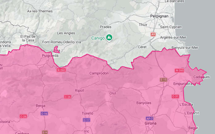
That’s so Spain to just leave an exclave in France
Those are just decoration
Man, the mercator projection really messes up the perspective, I never would have guessed!!
This is surprising to a lot of people because everyone is used to seeing mercator projection maps, which skew the true size of countries