

Using data from an instrument designed by NASA’s Jet Propulsion Laboratory in Southern California, the nonprofit Carbon Mapper has released the first methane and carbon dioxide detections from the Tanager-1 satellite. The detections highlight methane plumes in Pakistan and Texas, as well as a carbon dioxide plume in South Africa.
The data contributes to Carbon Mapper’s goal to identify and measure greenhouse gas point-source emissions on a global scale and make that information accessible and actionable.
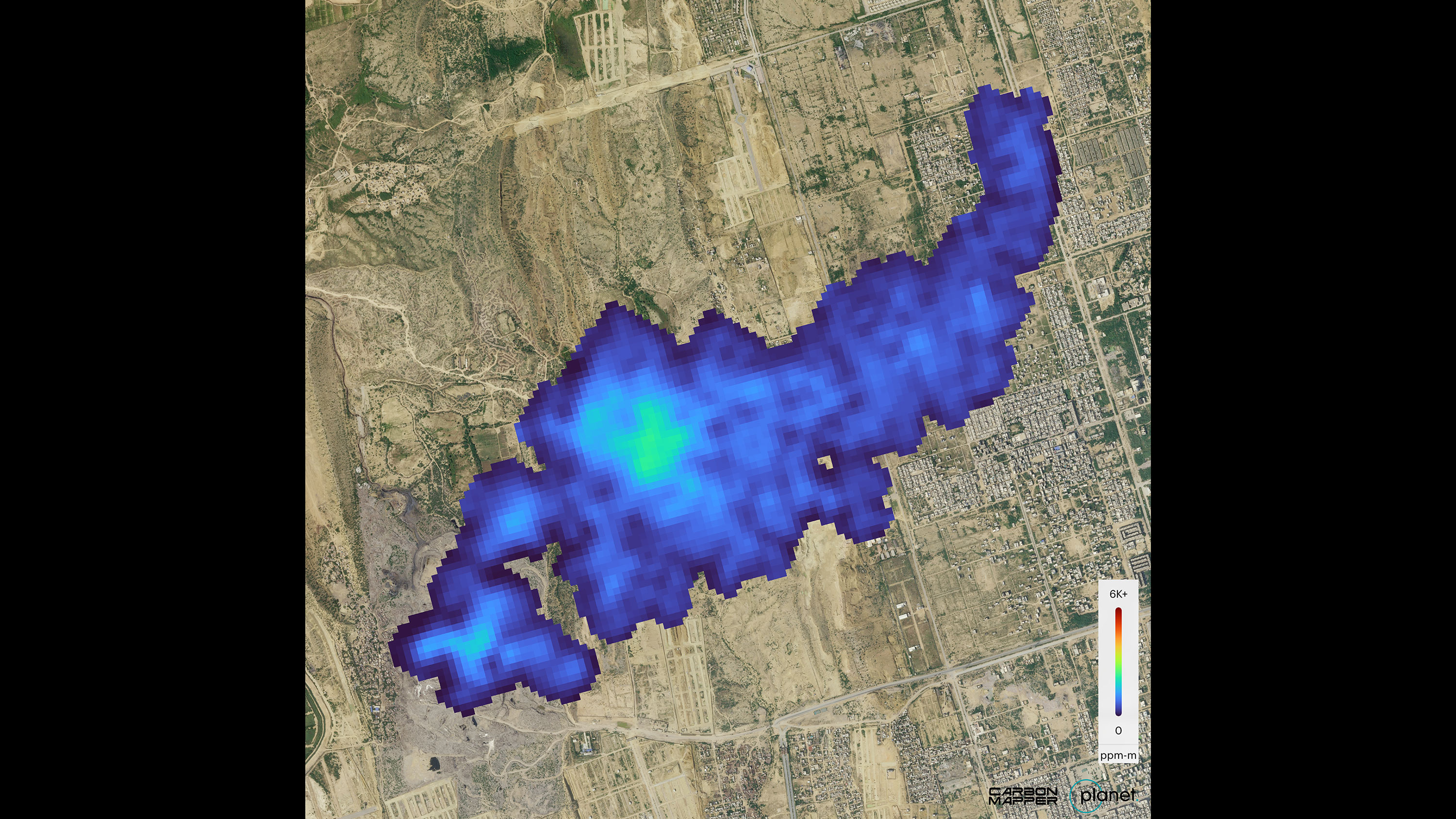
The data used to produce the Pakistan image was collected over the city of Karachi on Sept. 19 and shows a roughly 2.5-mile-long (4-kilometer-long) methane plume emanating from a landfill. Carbon Mapper’s preliminary estimate of the source emissions rate is more than 2,600 pounds (1,200 kilograms) of methane released per hour.
The image collected that same day over Kendal, South Africa, displays a nearly 2-mile-long (3-kilometer-long) carbon dioxide plume coming from a coal-fired power plant. Carbon Mapper’s preliminary estimate of the source emissions rate is roughly 1.3 million pounds (600,000 kilograms) of carbon dioxide per hour.
The Texas image, collected on Sept. 24, reveals a methane plume to the south of the city of Midland, in the Permian Basin, one of the largest oilfields in the world. Carbon Mapper’s preliminary estimate of the source emissions rate is nearly 900 pounds (400 kilograms) of methane per hour.